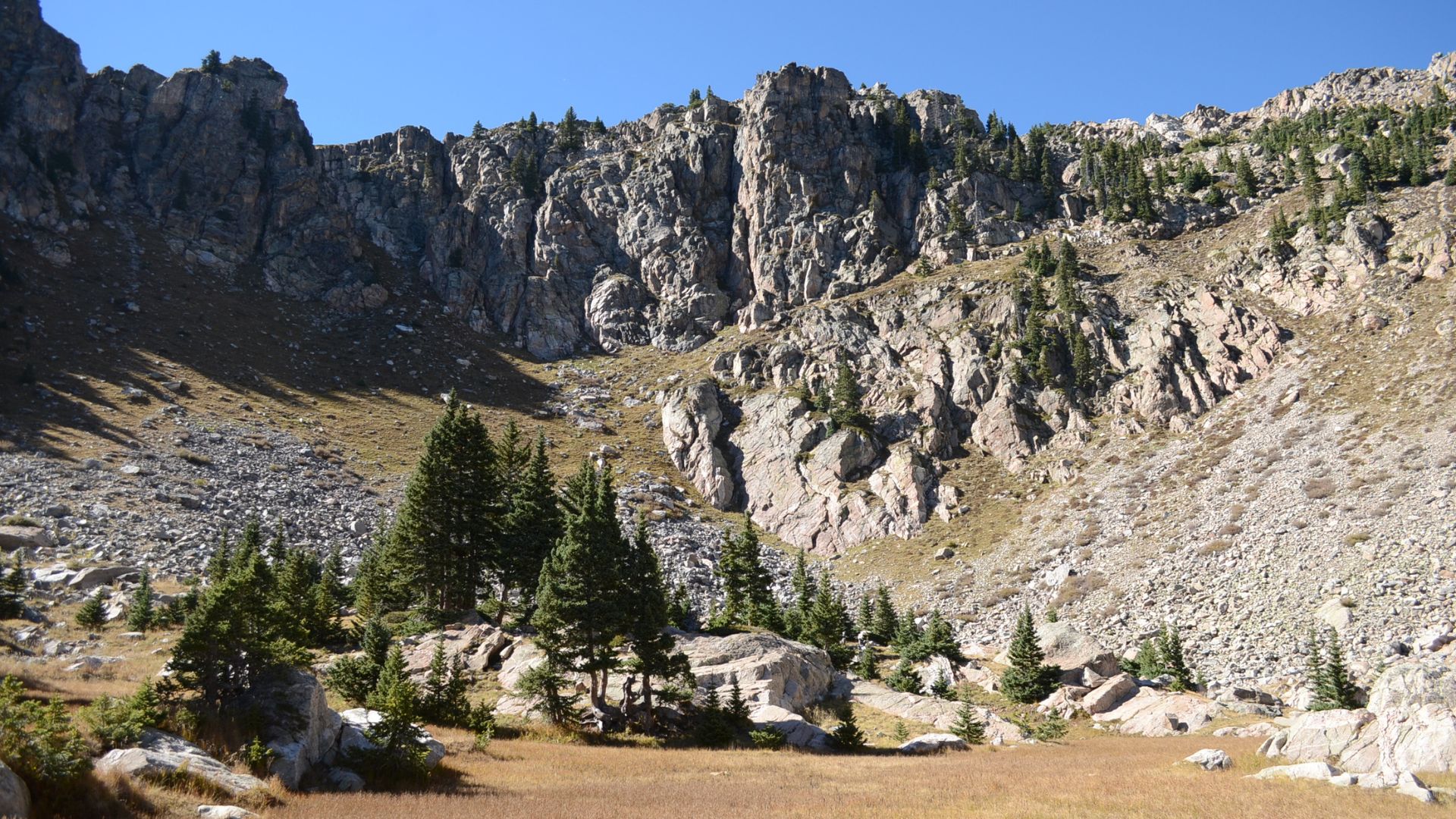


*The above photo was taken on Lake Katherine Trail
From easy to difficult, we’ve curated your ultimate list of the best Santa Fe hikes. Venturing out on any of these trails will renew your mind, body, and soul. After a day on the trails, schedule a spa day for some much-needed pampering.
While hiking can be strenuous, hiking for pleasure is first and foremost in Santa Fe. Why? Because Santa Fe is a wonderfully unique and awe-inspiring place. Nestled at the foot of the Sangre de Cristo Mountains, hikers encounter vivid blue skies, clean air, stunning sunsets, incredible vistas, and ancient history.
Add to that year-round accessibility, a variety of trails for all skill levels, and a peacefulness reminiscent of long ago, and you’ll soon understand what sets this enchanted land apart from everywhere else. Lace up your hiking boots and get ready for the best hikes in or near Santa Fe.
Note: Some of these trails might be temporarily closed during the dry season, depending on the status of wildfires. Call ahead to confirm accessibility.
Make FREE accounts with Hiking Project and AllTrails to save these hikes so you can find them easily later. Download the corresponding apps for on-the-go access.
Remember to Leave No Trace, bring plenty of water, electrolytes, snacks, and pack layers!
Best EASY Hikes near Santa Fe
Nature Conservancy Loop At Santa Fe Canyon Preserve
Length: 1.5 miles
Elevation: Mostly level
Type: Loop
Location: Upper Canyon Rd & Cerro Gordo Rd
Established in 2000, the Santa Fe Canyon Preserve has grown to encompass 525 acres of wildflowers, willows, birds, deer, and beavers. Located just a few miles from Santa Fe’s historic downtown plaza, this Southwestern oasis offers hikers, bird watchers, and nature lovers a 1.5-mile interpretive loop trail through the Santa Fe River wetland area and historic dam site. You’ll find details about the area’s fascinating history and fragile ecology.
Two Mile Pond Loop
Length: 1.4 miles
Elevation: 91 ft.
Type: Loop
Location: Cerro Gordo Trailhead off Cerro Gordo Rd
You’ll enjoy a variety of bird sightings on Two Mile Pond Loop, a pleasant and easy trail with scenic views and a peaceful pond. The trail is not clearly marked, so use a trail map.
Randall Davey Audubon Center
Length: 0.6 miles
Elevation: 104 ft.
Type: Loop
Location: 1800 Upper Canyon Rd
Randall Davey Audubon Center features an easy nature trail with pretty vistas and the possibility of seeing deer, turkey, woodpeckers, and other wildlife. This scenic spot is also the perfect place for a picnic lunch. Visitors can enjoy browsing the nature center before or after the hike.
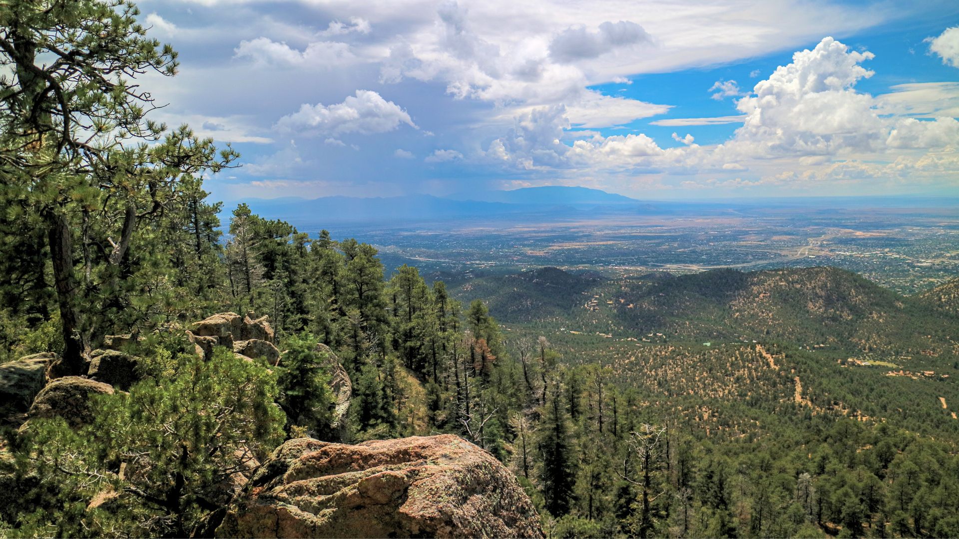
View from the top of Atalaya Mountain
Best MODERATE Hikes In Santa Fe
Sun Mountain
Length: 1.6 miles
Elevation: 734 ft.
Type: Out and back
Location: Sun Mountain Trailhead, Old Santa Fe Trail
Sun Mountain is a popular out-and-back trail in the Santa Fe foothills. Note that there is no dedicated parking, and some hikers report loose or slick terrain; trekking poles are recommended.
Near the top, you come upon a large, smooth rock crop that cascades down like a granite waterfall. Keep going up a fairly steep, rocky staircase to the summit. Take in breathtaking views of the Ortiz and Sandia Mountains to the south and southwest and the Jemez Mountains to the west. Leashed dogs are welcome.
Moon Mountain (Monte Luna)
Length: 2.7 miles
Elevation: 738 ft.
Type: Out and back
Location: Atalaya Trailhead at St. John’s College
Moon Mountain Trail is well-marked and maintained. It offers beautiful views, the sound of wind in the trees, and a relatively steep ascent and descent.
West and East Circle Loop in Hyde Memorial State Park
Length: 3.0 miles
Elevation: 1,115 ft.
Type: Loop
Location: Hyde Memorial State Park
Circle Loop starts with much of the total elevation gain and then flattens onto a ridge. From the ridge, you can see the old Santa Fe Ski Basin. Some structures and tow ropes can be seen from across the canyon. At the summit, enjoy views of Ski Santa Fe and the mountains to the west.
Chamisa Trail
Length: 4.3 miles
Elevation: 1,115 ft.
Type: Loop
Location: 239-251 Hyde Park Rd
This moderately challenging, well-shaded hike offers no significant views but plenty of beautiful trees, woodpeckers, songbirds, and butterflies. There is a bit of uphill and downhill but with excellent footing. During the colder months, there may be ice, so wearing spikes can be helpful.
Dale Ball Trails North
Length: 4.4 miles
Elevation: 567 ft.
Type: Loop
Location: Wilderness Gate Trailhead on Hyde Park Road
Well-defined with many ups and downs, Dale Ball North Trail will provide views of the mountains and some homes in the distance. There is moderate shade as the trail winds through a piñon juniper forest.
Aspen Vista Trail
Length: 5.9 miles
Elevation: 2,020 ft.
Type: Loop
Location: NM-475 & Aspen Vista
The Aspen Vista Trail begins at the Aspen Vista overlook. You’ll follow a dirt road up to the top of the ski area, where you’ll be rewarded with a stunning view. After taking photos (and a break), turn around and head back down. You may see wildlife, such as elk, deer, mountain lions, and many alpine bird species. It is beautiful in the fall when the aspens turn their signature golden yellow. Tip: some hikers recommend going counterclockwise.
Atalaya Mountain Trail
Length: 6.2 miles
Elevation: 1,797 ft.
Type: Out and back
Location: Santa Fe National Forest
Located just outside Santa Fe, you will park your car at the trailhead at St. John’s College. The Atalaya Mountain Trail is a popular and challenging hike that leads you through ponderosa pines, junipers, and piñons to a summit that rewards the effort with incredible views. During the warmer months, bring plenty of water and sunscreen. If time is limited, you can set out from Ponderosa Ridge trailhead.
La Tierra Trails Loop
Length: 10.5 miles
Elevation: 941 ft.
Type: Loop
Location: 1212 La Cuchara Rd
Great for beginners, La Tierra Trails Loop offers hikers elevation changes, great trail conditions, clearly marked trails, and excellent views.
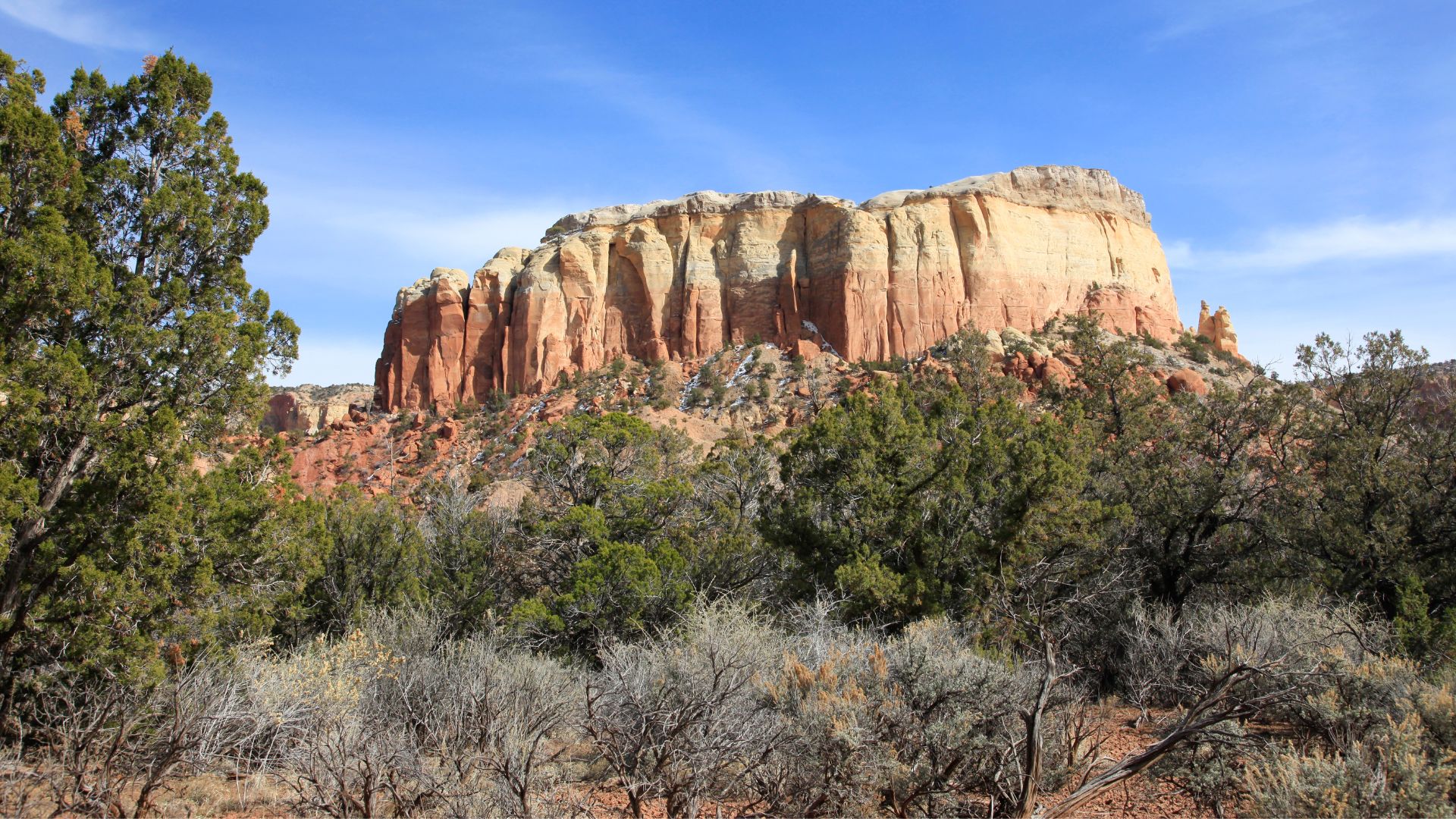
Kitchen Mesa Trail
Best DIFFICULT Hikes In Santa Fe
Alamos Vista (Tessa’s Trail)
Length: 2.4 miles
Elevation: 1,187 ft.
Type: Out and back trail
Location: Aspen Vista Trailhead on Hyde Park Road
This moderate trek is steep both up and back, but the view makes it worth it. Elk might graze along the way, and the aspens are especially beautiful in the fall. Snowshoes or spikes are recommended if you hike Alamos Vista during the winter.
Kitchen Mesa Trail
Length: 3.7 miles
Elevation: 718 ft.
Type: Out and back
Location: Kitchen Mesa Trailhead, Ghost Ranch Conference Center
Located near El Rito, New Mexico, Kitchen Mesa Trail is a popular, moderately challenging trail and takes 1.5 to 2 hours to complete. The best time to hike it is March through October.
Picacho Peak Trail
Length: 3.7 miles
Elevation: 1,227 ft.
Type: Out and back
Location: The Nature Conservatory, 1670 Upper Canyon Rd
Discover incredible views of mountains, animal life, and wildflowers. Three lookout points along the trail offer scenic views of Santa Fe. Most of the trail is in the shade, but there are some sunny areas as you gain elevation. Leashed dogs are welcome.
Nambé Lake Trail
Length: 6.3 miles
Elevation: 2,057 ft.
Type: Out and back
Location: Winsor Trailhead, Hyde Park Rd
Not for the faint of heart, the Nambé Lake Trail offers steep climbs and stunning views. Look for the Windsor Trail sign at the Santa Fe Ski Basin parking lot. You will trek through the scenic Sangre De Cristo subrange of the Southern Rockies. The trail has a moderate incline at the start, as it winds through aspen and pine trees. The downhill portion leads to Nambé Creek, which is mostly shaded with pine trees. But on the return, you will tackle some serious elevation.
Santa Fe Baldy via Winsor Trail
Length: 13.5 miles
Elevation: 3,464 ft.
Type: Out and back
Location: Winsor Trail
This out-and-back trek reaches Santa Fe Baldy Via Winsor Trail. The first half of the trail is the same as the Nambe Lake Trail. This route is also a lightly traveled favorite for serious hikers, especially in the fall when golden carpets lead up to the pines and eventually the saddle and summit for incredible views.
What starts as a steep mile of switchbacks turns into a slow descent through mossy pines and elegant aspens. Baldy comes into view from the left side of the trail. Continue onward until you cross Nambe Creek and begin to climb again. Another switchback series takes you above the tree line to the saddle. From there, it’s a steep scramble over marmot rocks to reconnect with the trail above. Be wary of summer storms, wear layers in the fall months, and bring plenty of water. Dogs are welcome.
Lake Katherine
Length: 14.1 miles
Elevation: 2,982 ft.
Type: Out and back
Location: Aspen Basin Campground Parking on Hyde Park Rd
Lake Katherine via Winsor Trail is a very demanding day hike. This trail is the same as Nambe Lake and Baldy, but it continues around Baldy to the lake rather than ascending to Baldy. Lake Katherine is larger than nearby Lake Nambe and Spirit Lake. The water is so clear! Dogs are welcome.
Santa Fe Hiking Accommodations
After taking advantage of these best hikes in Santa Fe, NM, amidst the colorful landscape, you’ll relish the luxurious amenities at the Inn of the Turquoise Bear. Kick back and relax in one of our courtyards or iconic Santa Fe guest rooms. You’ll find a peaceful and authentic setting to enjoy a favorite beverage while reflecting on the incredible day.
Here are more hiking trails in Santa Fe to try:
Try Our Santa Fe Hiking Packages
We also offer guests a hiking guide and the Trekking Experience for Two, which includes hiking poles, food, and everything needed to explore Santa Fe’s natural landscapes.
Before you head out, arrange to take along one of our deluxe picnic baskets. They’re perfect for refueling after a few hours on the trail.
We hope to see you soon. Book Now.
Photo Credit:
© EvanCurtis via canva.com
© Laurie Drake via canva.com
© Panmaule via canva.com